| Hastings Cutoff |
Trail Guide |
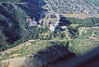
Salt Lake City |
Dead Man's Cave |
Benson's Mill |
Grantsville |
Timpie Point |
| Horseshoe Springs | Redlum Springs | Hastings Pass & Summit | West of Hastings Pass | I-80 | Evaporating Pond |
| Floating Island | Silver Island Point | Bomb Target | Donner Springs | Emigrant Graves | All Photos |
| Horseshoe Springs | Redlum Springs | Hastings Pass & Summit | West of Hastings Pass | I-80 | Evaporating Pond |
| Floating Island | Silver Island Point | Bomb Target | Donner Springs | Emigrant Graves | All Photos |
We begin out tour at the east bank of the Jordan River. Drive to 900 west via 2100 south then drive south to 2780 south street and turn right and go west until road ends at the Jordan River Parkway. Walk north along the paved pathway about 300 feet to the rail post monument with a quote from James Reed's diary which reads:
HASTINGS CUTOFF-UTAH OUTLET [JORDAN RIVER]
"Son 23 left camp late this day on acct. of having to find a good road or pass through the swamps of the Utah outlet. ... encamped on the east bank. ... "
James F. Reed, Aug 23, 1846
2000 Utah Crossroads Chapter - OCTA HU 5
 |
| This is the mouth of Emigration Canyon where the Donner Party had such a hard time pulling each wagon, with all the oxen, up the steep bare slope at the left of the tall, white, condo. building. The Mormons the next year followed the stream bed, by the curving emigration road in the center of the picture. |
Donner Reed party after exiting Emigration Canyon, followed the Mill Creek stream down to the Jordan River which is just south of 2700 south [Salt Lake City block numbers]. The Mill Creek Channel was straightened some years ago and according to eye witnesses the original channel was just north of the rail post. James Clyman knew of this crossing and when he guided Hastings & Hudspeth east in June of 1846, they crossed here. Later on in August Hudspeth now guiding the Bryant/Russell mule mounted pack party, came to this same crossing after the party had camped on John C. Fremont's camping spot on City Creek near where the Temple stands today. Since Hudspeth knew of the crossing, he led the B/R party down through 2 miles of bull rushes and swamps created by the combination of Mill, Parleys, Emigration and Red Butte creeks flooding the area north of 2700 south.
Edwin Bryant wrote in his journal on July 31, 1846:
"Morning clear, with a delightful temperature, and a light breeze blowing from the west. .... Decending from the upland slope on which we encamped yesterday, [on City Creek] we crossed a marsh about two miles in width, covered with grass so dense and matted that our animals could scarcely make their way through it [ from about 15th south to 27th south]. ... We reached the Utah Outlet [Jordan River] after travelling four miles, and forded it without difficulty. The channel is about twenty yards in breadth, and the water in the deepest places about three feet. The bed of the channel is composed of compact bluish clay. The plain or valley, from the western bank of the "Outlet" to the base of the range of hills to the west [Oquirrh Mountains], is level and smooth, and in places white with a saline deposite or efflorescence. There is but little vegetation upon it, and this is chiefly the wild sage, indicative of aridity, and poverty of soil. From this plain we struck the shore of another bay of the Salt Lake, bordered by a range of mountains running parallel with it. The shore, next to the white crust of salt, is covered with a debris precipitated from the rocky summits of the mountains."
The Harlan / Young company crossed the Jordan River at North Temple and the Lienhard/Hoppy company crossed some 6 1/2 miles further north. After the Mormons settled in the valley, North Temple became the preferred crossing for the later Emigrants after they had rested, refurbished their supplies in Salt Lake City.
After visiting the Jordan River site, drive back to 900 west then turn right and drive 0.8 miles to 3300 South, turn right on 33rd and proceed 1.1 miles to Redwood Road then again turn right [north] 0.4 miles to 3100 south street and go left or west on that street. It is this authors opinion that the Donner Reed party slowly bent their trail to the south to avoid the springs and wet areas between here and the Oquirrh Mountains. Their travel would be easier to stay up on the slight rise in the ground about on 3100 south. Notice the lower and sometimes wet areas just to the north. Continue west 8.0 miles to 8400 west, turn right 0.4 miles to 2700 south. Then left 0.4 miles to 9180 west and then drive through Magna, then turn right and go 0.5 miles to 2100 south street extension or U-201. Turn left at the stop sign and head west on U-201.
James Reed wrote:
"Mo 24 left our Camp [on the Jordan] and Crossed the plain to a spring at a point of the Lake mountain and 1 1/2 miles from the road traveled by the people who passed the Cannon 12 [In margin: Brackish water] [In margin still later: it took 18 days to gett 30 miles]"
Notice the high embankment across the canal on your right. This is a dike to hold the Kennecott Copper Corporations [KCC], tailings which is like fine sand & rock powder. The production of copper from the KCC mine, requires the mineral ore bearing rock from the pit to be crushed to almost a fine powder and the copper and other minerals are floated in classifiers by chemicals mixed with water. After the copper, gold, silver, lead, molybdenum and other minerals are removed, the remaining material [tailings] is piped and pumped on to the huge tailings pond for disposal. The mineral concentrate is then shipped to the cokeing ovens then on to the smelter where the minerals are separated in a molten form and cast into ingots for easier handling. There is enough gold in the ore rock to help pay for some of the operations.
Continue on U-101 for 3.8 miles to the former town site of Garfield. When the road curves to the left heading west, you will turn to your right and east then come to a locked gate. This is KCC property and the cave mentioned in the emigrant diaries is on the east side of the rock outcropping which is now called Dead Mans Cave because a skeleton that was found in the cave by the emigrants. If we are granted permission we will visit the cave.
| Trail Guide |
|---|