

PLATE XIV.
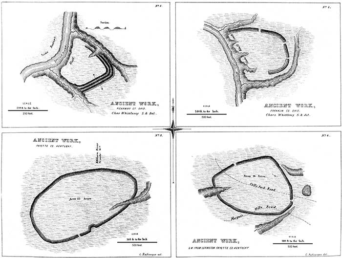
NUMBER 1.—This work is situated near the north line of Pickaway county, Ohio, on the right bank of the Scioto river. It is entirely analogous to many of those already described; and is only remarkable as possessing three lines of embankment, with corresponding ditches, as shown by the section a b. "The ditches are here interior to the walls, which circumstance is adverse to the idea of a defensive origin. The situation, however, with a steep bank and deep water on one side, and deep ravines with precipitous banks on the others, is one of great natural strength and adaptation for defence. The walls are now very slight."
NUMBER 2.—This work is, in most respects, similar to the one last described. It is situated four and a half miles north of Worthington, Franklin county, Ohio, on the left bank of Olentangy creek. The artificial defences consist simply of an embankment of earth, three feet in height, with an exterior ditch of corresponding depth. The natural defences are sufficiently obvious. Both of these plans are from surveys by CHARLES WHITTLESEY, Esq.
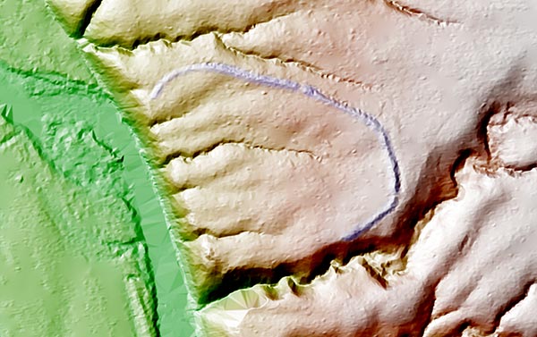
[These earthworks been preserved and are part of the Highbanks Metro Park. This is a LIdar hillshade of the site. GPS: 40.140803063, -83.028981686.]
NUMBER 3 AND 4.—The character of these works is sufficiently explained by the engravings. From the position of the ditch and other obvious circumstances, they have been classed as of defensive origin. They are from the Rafinesque MSS,
Copyright © 2009 Calvin & Rosanna Hamilton. All rights reserved.