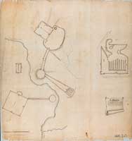
SIA3996: Ancient Works Along the East Fork of the Little Miami River

|
|
Related Documents
Download Options
| Image Name | Width x Height | Size |
|---|---|---|
| SIA3996.jpg | 1800 x 1918 | 178K |
| SIA3996.jpg | 4000 x 4262 | 1M |
| SIA3996.jpg | 8056 x 8584 | 9M |
Caption
This map was drawn in 1823 as was apparently don by Maj. Isaac Roberdeau the head of the Bureau of Topographical Engineers, U.S. Army Corps of Engineers.
E.G. Squier published similar surveys in "Ancient Monuments of the Mississippi Valley", Plates 34 No. 1 & 2. These works were completely destroyed.
Copyright © 2005-2009 Calvin & Rosanna Hamilton. All rights reserved.