Haleakala Directions
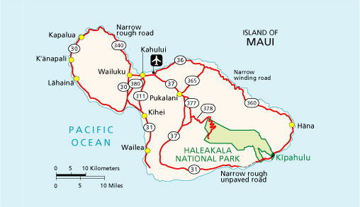 Haleakala National Park extends from the 10,023 foot (3055m) summit of Haleakala down the southeast flank of the mountain to the Kipahulu coast near Hana. These two sections of the park are not directly connected by road, but both can be reached from Kahului.
There is no public transportation available either to or in the park.
To the Summit Area:
Park headquarters and the 10,023 foot (3055m) summit can be reached from Kahului via Route 37 to 377 to 378. Driving time to the summit from Kahului is approximately 1.5 hours.
To the coastal area (Kipahulu):
Kipahulu is reached via Route 36 to 360 to 31. Driving time from Kahului is approximately 3 hours.
Maps
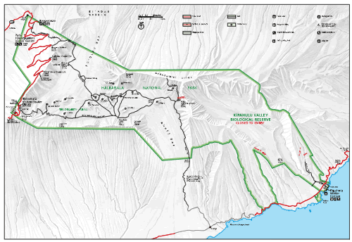
- Topographic Haleakala Map (.pdf file, 282kb)
- Map of Hiking Trails (.pdf file, 111kb)
Copyright © 2005-2009 Calvin & Rosanna Hamilton. All rights reserved.