SIA3190: Grassy Mountain Range
|
|
Related Documents
Download Options
| Image Name | Width x Height | Size |
|---|---|---|
| SIA3190.jpg | 640 x 427 | 66K |
| SIA3190.jpg | 1200 x 800 | 214K |
| SIA3190.jpg | 2640 x 1760 | 708K |
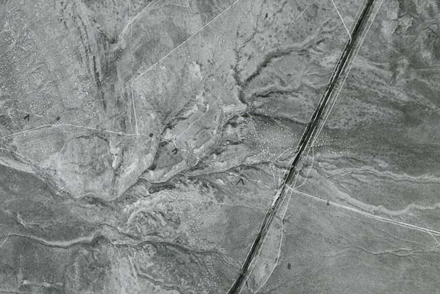
Caption
This is an aerial photo of the trail crossing some washes at the end of the Grassy Mountain Range. The trail is the white line going from lower right to the center left. The dark line is the Western Pacific Railroad and the Aragonite Plant where it crosses the trail. The line from the top center down to the trail is the Victory Highway where it traveled on the trail for a short distance.
Copyright © 2005-2009 Calvin & Rosanna Hamilton. All rights reserved.