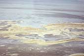
SIA3211: Sand Dune Area Used as Evaporation Pond

|
|
Related Documents
Download Options
| Image Name | Width x Height | Size |
|---|---|---|
| SIA3211.jpg | 640 x 431 | 39K |
| SIA3211.jpg | 1200 x 808 | 138K |
| SIA3211.jpg | 3159 x 2128 | 1M |
Caption
This is the sand dune area showing where the water flows since this area was used as a evaporation pond. The trail went from lower right, through the center and upper left of the photo. Note the thin line in the upper left . This is the dike and road around the evaporation ponds that goes from the upper left to the upper center of the photo on the right.
Copyright © 2005-2009 Calvin & Rosanna Hamilton. All rights reserved.