SIA3268: Countour Map
|
|
Related Documents
Download Options
| Image Name | Width x Height | Size |
|---|---|---|
| SIA3268.jpg | 640 x 415 | 56K |
| SIA3268.jpg | 1200 x 779 | 176K |
| SIA3268.jpg | 2436 x 1582 | 837K |
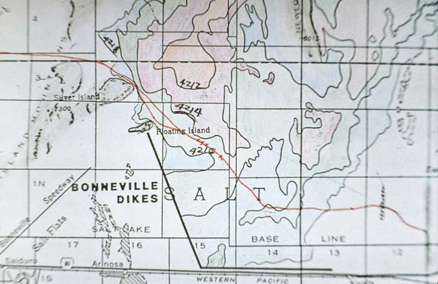
Caption
This is a contour map showing the actual trail as a red line. It shows the big bend and the retrieval trail above the g in the word Floating. The wagon excavations took place by the 4216 contour line. You will note how close the wagons came to the 4214 line (area shaded in red). This lower area would be wetter and cause the emigrants many more additional problems than they had. Note the faint line under the 4214 elevation. This was the trail expounded by one historian because he believes they went in a straight line. Traveling in the 4214 and lower area would have been a complete disaster.
Copyright © 2005-2009 Calvin & Rosanna Hamilton. All rights reserved.