|
|
Related Documents
Download Options
| Image Name | Width x Height | Size |
|---|---|---|
| SIA3421.jpg | 640 x 432 | 36K |
| SIA3421.jpg | 1200 x 809 | 106K |
| SIA3421.jpg | 3160 x 2128 | 1M |
Caption
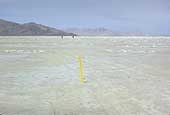
This is the main Hastings Trail after the 6 inches of salt have been dissolved and carried of to the north. The yellow carsonite is standing by a concrete beam that Dan Miller & I placed in 1986 to mark the trail. The beams are 6 inches square and about 15 inches long. We dug a hole in the center of the trail and left about 4 inches exposed to the surface. After the pumping project and the evaporation of the salt water, a group of us looked for the trail in 1990, when we were about to give up, Dave Bigler found a square block of salt above the rest and found the concrete block. We placed a block about every 2000 feet apart in this section of trail. Silver island Point is to the right of the men.