| Hastings Cutoff |
Trail Guide |
Salt Lake City |
Dead Man's Cave |
Benson's Mill |
Grantsville |
Timpie Point |
| Horseshoe Springs | Redlum Springs | Hastings Pass & Summit | West of Hastings Pass | I-80 | Evaporating Pond |
| Floating Island | Silver Island Point | Bomb Target | Donner Springs | Emigrant Graves | All Photos |
| Horseshoe Springs | Redlum Springs | Hastings Pass & Summit | West of Hastings Pass | I-80 | Evaporating Pond |
| Floating Island | Silver Island Point | Bomb Target | Donner Springs | Emigrant Graves | All Photos |
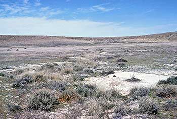 |
| This is the trail as it approaches the Grayback Hills. |
After your break, continue west on I-80. At the bottom of the hill, if you look quick, you can see the white carsonite markers marking the trail on both sides of the road. Be careful and don't slow down too much because of the fast traffic. Before I-80 was built there was a rock monument on the north side of old US-40 that honored the Donner/Reed Party. The monument was removed to the State shed at Granstville but no one has seen it since. There is a rail post marker north of the frontage road which reads:
HASTINGS CUTOFF - ROCKY HILL AHEAD
"Some 2 miles ahead of us we could see a rocky hill [Grayback Mountain] which rose about 40 feet above the plain, and over which the road led."
Heinrich Lienhard, Aug 18, 1846
2000 Utah Crossroads Chapter - OCTA HU - 17
Continue west to the next interchange which is called the Clive Interchange and take the exit. South of here is the depository for low grade, hazardous nuclear waste. After you come to the stop sign, then turn right and turn right again on to the frontage road and travel east 2.3 miles to a dirt road heading northwest. CAUTION: Do not take these dirt roads if it is raining or wet. The clay on these roads, when wet, is just like slippery soap. Turn left on the dirt road and drive 2.0 miles to where trail crossing area is. The author has flown over this area several times and the trail is easy to see from the air but on the ground it is very difficult to find. It also shows up good on aerial photos.
LIENHARD again: "Some 2 miles ahead of us we could see a rocky hill [Grayback Hills] which rose about 70 feet above the plain, and over which the road led."
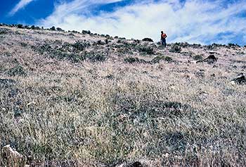 |
| This is a photo of Dan Miller standing in the trail on the east side of Grayback. |
Continue on dirt road for 0.3 mile to a two track road on the left. Take this road and travel 1.4 miles to a earth stock pond. You will travel on the north side of a mounded earth stock tank. This is a ranchers reservoir for rain water with just mounds of earth pushed up to retain the water from a small wash for watering stock. Continue west around the pond to a main graded dirt road then turn left and follow the road around a spur of the mountain and go up a valley then climb up a steep dugway to the top of Grayback. This dugway requires a 4 wheel drive. Once on the top make a sharp turn left and follow the rough wheel tracks to the south to a carsonite and steel rail marker on the summit where the trail crosses. The plaque on the steel rail marker reads:
HASTINGS CUTOFF - GRAYBACK SUMMIT
"... and yet we crossed one steep hill in the night when we had to put our shoulders to the wheel in earnest, lifting the wheels over rocks three & four feet high ..."
John Wood. Aug 5, 1850
2000 Utah Crossroads Chapter - OCTA HU - 18
 |
| This is a view of the imaginary waves of the Great Salt Lake that Edwin Bryant & Rusell saw from the summit of Grayback on a moonlight night when they were on the summit of Grayback. |
In the area of the rail post in 1975 the author found a small broken bitters bottle, which he gave to the BLM man with us, for analysis. This man was transferred and we never heard from him again. Looking back down the east side, the trail comes up a sort of natural dugway just below where the carsonite marker is. Further down is a wash which could have been the original eroded trail heading back to the south side of the stock tank where you can see the trail from the aerial photos. Turn around and walk to the west side where you can see where the black volcanic boulders, showing a white under belly, were turned over by the emigrants to make a road. If you look to the northwest you can see a parallel road on the south side of the trail. The trail has larger sage brush sporadically growing in it.
Turn your vehicle around and follow your tracks back down from the summit. Be especially careful going the few feet off the summit, it is treacherous & steep. Continue on down the valley and past the stock tank to the graded dirt road. Go right until you reach the frontage road then turn right again. Note your odometer reading then continue west and past the Clive Interchange; go up over the south flank of Grayback and look for a dirt road on your right at 1.8 miles from where you turned on to the frontage road.
Turn right on this dirt road [if it is dry] and travel 4.7 miles north-northwest where you will come to a cross road and a carsonite marker. Turn right and follow the tracks for 1.2 miles to the bottom of the Grayback Hills. This is where the emigrants came off of the ridge.
Where you turn around, there is a circle of rocks, that could have been for a fire pit used by the emigrants. One party mentions stopping in this area to eat and to rest.
Follow the tracks back and pass the carsonite. The trail trace and & any depression is on the right side within five to ten feet of your vehicle. Continue on this road for 2.05 miles, following the trace with its large sporadic sagebrush, until you come to a rail post. The plaque on the posts reads:
HASTINGS CUTOFF - SMOOTH PLAIN
" We entered upon the hard smooth plain we had just been surveying.... composed of bluish clay, encrusted, in wavy lines, with a white saline substance...."
Edwin Bryant, Aug 3, 1846
2000 Utah Crossroads Chapter - OCTA HU - 19
 |
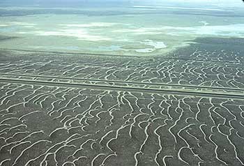
| The trail runs diagonally from the lower right hand corner across the north end of the Knolls Flight Strip to the white area in the center of the photo. |
This post is next to the side borrow cut that was made during the construction of the emergency flight strip for the Wendover Air Force training facility at the beginning of the 1942 World War II build up. The north end of the Flight Strip cut right across the Hastings Cutoff Trail. The trail can still be seen from the air on both sides of the strip.
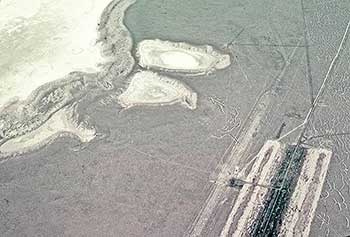
Continuing on: After we leave the Smooth Plain marker, turn right on the edge of the flight strip borrow cut, note the odometer reading then follow the road north where it gradually comes into a gravel road. Continue on north for 3.25 miles then turn right for a short side trip of -----mile to some bomb craters on the flats. Turn around and follow the road back to the north south gravel road. For an experience of what its like in the middle of the mud flats take the tour on the Magnesium Corporation evaporating pond dikes.