| 24-25 | 26 | Aug 27 - Sep 4 | 5 | 6 | 7-8 | 9 | 10 | 11 | 12 | 13 | 14 | 15 | All Photos |
August 15, 1841
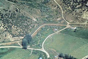
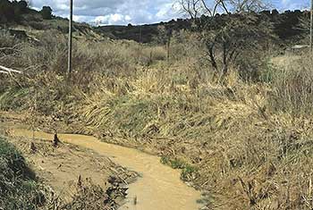
Turn right onto this gravel road and travel 0.2 miles to a fork in the road. The stream at the fork is Battle Creek. The Bear River Massacre took place in the area from the mouth of the ravine to the north and south to the Bear River. The battle occurred on 29 January 1863 between a band of Northwestern Shoshone Indians and soldiers from newly founded Camp Douglas in Salt Lake City, commanded by Colonel Patrick Edward Connor. The battle was prompted by harassment of overland travelers, settlers, and miners by the Indians, whose traditional lands were rapidly being preempted by the whites. Approximately 250 Indian men, women, and children were killed, along with fourteen soldiers. Many soldiers were afflicted by the extremely cold weather. There is a monument to this battle on the east side of US 91, just north of the Bear River bridge.
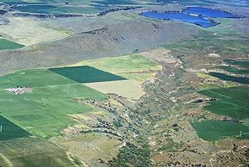
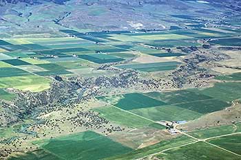
Travel down the left-hand fork. Note the deep ravines on the right as you travel the next 4.0 miles. These ravines caused the emigrants to travel in almost every direction. One mile from the fork the road changes from gravel to pavement. Continue on the pavement 0.3 miles to the second fork in the road. Take the left-hand fork, a gravel road, and travel 1.1 miles to the junction with a paved road.
Turn left onto the paved road and travel 1.7 miles to the junction with an east-west road. Turn right onto this road and travel 1.3 miles to the junction with 3200 West. Turn left onto 3200 West and travel south 4.6 miles to the junction with 3600 South. Turn right onto 3600 South and travel 0.5 miles, past a railroad track, to the junction with SR 84. Turn right onto SR 84 and travel 1.0 miles to WESTON (11.5 miles).
The 15 AUGUST CAMPSITE is located just south of Weston on Weston Creek, three miles from the Bear River. Bidwell and John both described the scene. John Bidwell wrote:
First Overland Emigrant Party
"Continued our journey over hills and ravines, going to almost every point of the compass in order to pass them. ... Having come about 15 miles, we encamped on a small stream proceeding out of the mountains at no great distance from us. But we were surprised to see it become perfectly dry in the course of an hour; some of the guard said there was plenty of water in it about midnight."
John Bidwell, Sunday, August 15, 1841
2002 Utah Westerners Foundation & Utah Crossroads Chapter OCTA BB ID - 5
Continued our journey over hills and ravines, going to almost every point of the compass, in order to pass them. having come about 15 miles, we encamped on a small stream proceeding out of the Mountains at no great distance from us. But we were surprised to see it become perfectly dry in the course of an hour, some of the guard said there was plenty of water in it about midnight.
James John wrote: "today we did not travel for perhaps not more than 8 miles on a straight line but the way was rough and winding and hilly we encamped on a small branch about 3 miles from the river that is from Bear river."
August 14, 1841  |
 August 16, 1841 August 16, 1841 |
|---|
